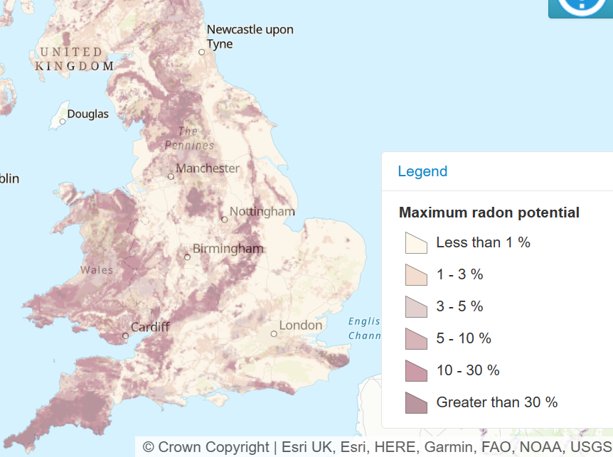
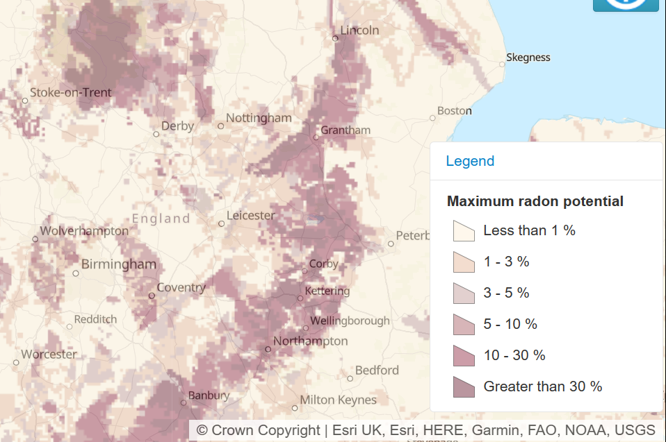
New maps showing the revised extent of the radioactive gas radon have been published by the UK Health Security Agency (UKHSA) and British Geological Survey (BGS).
Cited as a “significant update” by the BGS, the new maps were released on 1st December 2022 and came into effect immediately. The construction industry was taken by surprise by the new data, especially given the implications for all new construction and building projects which may require additional protective measures.
Radon is a radioactive colourless and odourless gas that occurs naturally in all rocks and soils. Continuous exposure can lead to health implications including lung cancer. It is attributed to around 1,100 lung cancer deaths per year in the United Kingdom.
The revised maps are based on 576,400 indoor radon readings taken by the UKHSA. Whilst this means that the maps are now more accurate, it also means that the number of properties now classed as being within radon affected areas in England, Wales, and Scotland has also increased.
The National House Building Council (NHBC) has now updated their Standards and Building Regulations to reflect the updated maps. From 1st of February 2023 all new construction projects will be required to have radon protection measures installed in accordance with the regulations.
Retrospective measures are not currently required for buildings and properties built before this date, but homeowners and landlords are being encouraged to take note of the new data and assess the potential impact.
Tracy Gooding, principal radiation protection scientist at UKHSA, said: “While the vast majority of buildings remain outside radon Affected Areas, if the property you own is in a radon Affected Area, it is important that you arrange for a test. If you live in private or social rented accommodation, speak to your landlord, who should organise a test for you to carry out.”
GRM is already advising and supporting clients where ongoing construction projects are impacted by the new regulations. Going forward, we will also work closely with landowners and developers who have yet to commence construction.
If you have any concerns about whether the radon assessment for your site has changed, then please do not hesitate to contact us. Please use your main point of contact at GRM or for new enquiries email richard.upton@grm-uk.com or call 01283 551249.
Details of the NHBC changes can be found here: https://www.nhbc.co.uk/builders/products-and-services/techzone/technical-updates/radon-protection-requirements
The new maps are available to view here: https://www.ukradon.org/information/ukmaps